
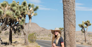
Here is a fun bit of trivia to pack for the drive: the place we now call Joshua Tree was once proposed as "Desert Plants National Park." That early name tells you a lot. This is a park built around living things that look like they wandered out of a storybook, from shaggy Joshua trees with arms flung in every direction to a garden of cholla cactus that glows gold at sunset.
Add giant stacks of granite boulders, two very different deserts meeting in one place, and some of the darkest night skies in Southern California, and you have a park that earns its spot on any national parks bucket list. It is also an easy one to reach from big cities, which makes it a wonderful first pin on your map.
Where is Joshua Tree National Park?
Joshua Tree sits in Southern California, about 140 miles east of Los Angeles, 175 miles northeast of San Diego and 215 miles southwest of Las Vegas. The closest airport is in Palm Springs. You can approach from Interstate 10 or from California Highway 62, the Twentynine Palms Highway.
There are three entrance stations. The West Entrance is five miles south of Highway 62 at Joshua Tree Village. The North Entrance is in the town of Twentynine Palms. The South Entrance near Cottonwood Spring sits along Interstate 10, about 25 miles east of Indio. Driving from the West Entrance to the North Entrance takes about 45 minutes, and from the North Entrance down to the South Entrance takes about an hour.
The park protects nearly 800,000 acres. President Franklin D. Roosevelt set it aside as Joshua Tree National Monument in 1936, and it became a national park in 1994 under the California Desert Protection Act.
Two deserts, one remarkable landscape
What makes Joshua Tree so special is that it straddles two ecosystems. The higher, cooler Mojave Desert covers the northern part of the park, and that is where you will find the namesake Joshua trees, especially in the western half along Park Boulevard and Keys View Road. The lower Colorado Desert, a western extension of the Sonoran Desert, fills the southern and eastern parts of the park with spiky ocotillo and the famously clingy "jumping" cholla. A third community of California juniper and pinyon pine grows in the Little San Bernardino Mountains above 4,000 feet.
Then there are the rocks. According to the park, the story began more than 100 million years ago, when molten rock cooled underground into a granite called monzogranite. Cracks formed in neat rectangular patterns, groundwater slowly rounded the blocks into spheres, and flash floods eventually washed away the softer soil and left the boulders piled on top of one another. You can see the results at Jumbo Rocks, Split Rock and the Wonderland of Rocks. The park also sits along the San Andreas Fault, which you can spot from the Keys View overlook.
Wildlife, starlight and the people of the desert
Joshua Tree is home to 57 species of mammals, 46 species of reptiles and more than 250 species of resident and migrating birds. The animals you are most likely to meet include antelope ground squirrels, jackrabbits, coyotes, red tailed hawks and ravens. With patience and luck you might spot a desert tortoise in spring or bighorn sheep in the rocky country near Barker Dam.
After dark, the show moves overhead. Joshua Tree is an International Dark Sky Park, and the park notes that many visitors see the Milky Way here for the very first time. Hidden Valley, Ryan Mountain and Quail Springs are designated stargazing areas, and the Pinto Basin Road between the Cholla Cactus Garden and Cottonwood has the darkest skies and the least traffic.
These lands are part of the traditional homelands of the Maara'yam (Serrano), Nüwü (Chemehuevi) and Kawiya (Cahuilla) peoples, and the traditional use area of the Aha Macave (Mohave). Today these communities make up 15 tribes. As for the Joshua tree's name, a popular legend credits Mormon pioneers, but the park points out that the story is not backed by the historical record.

Best things to do at Joshua Tree National Park
Wander the short loops of the boulder country
Some of the park's best scenery comes in small packages. The Hidden Valley loop is about one mile through a rock enclosed valley once rumored to hide cattle rustlers. The Barker Dam loop is about 1.1 miles and passes a water tank built by early ranchers. The Skull Rock loop is about 1.7 miles and, yes, the rock really does look like a skull.
Climb Ryan Mountain for the big view
If you want one hike with a payoff, Ryan Mountain is a three mile round trip with about 1,050 feet of climbing to the summit. It is one of the most popular hikes in the park. Save it for a cool day, and never attempt it in the heat.
Drive up to Keys View
Keys View offers sweeping views over the Coachella Valley toward the San Andreas Fault, Mount San Jacinto, Mount San Gorgonio and the Salton Sea. A short paved loop leads from the parking area. Parking fills quickly at sunset.
Catch golden hour at the Cholla Cactus Garden
About 20 miles north of the Cottonwood Visitor Center, a quarter mile loop winds through thousands of densely packed, naturally growing cholla cactus. Wear closed toe shoes, stay on the trail and keep your distance from those spines.

Camp among the rocks or tour Keys Ranch
The park has more than 500 campsites, and most of them are reservation only through Recreation.gov, bookable up to six months ahead. Hidden Valley, Belle and White Tank are first come, first served and fill fast on weekends from fall through spring. For a dose of homesteading history, ranger led tours of Keys Ranch usually run from October to April and require tickets from Recreation.gov.
Tips for planning your visit
- Best time to go: Fall and spring are the most comfortable, with highs typically in the 70s and low 80s. Winter nights can drop near freezing, and summer highs often reach 100°F or more.
- Fees and reservations: There is an entrance fee but no reservation system to enter the park. Check the official NPS website for current fees and any reservation requirements before you go.
- Bring everything: There are no gas stations, restaurants, grocery stores or hotels inside the park, and no water in the park interior. Cell service is very limited, so download the NPS app and its offline map before you arrive.
- Beat the crowds: Holidays, weekends from October to May and spring break season are the busiest times. Arrive early, and consider a weekday visit.
- Traveling with a dog: Pets are not allowed on trails except the paved Oasis of Mara Trail in Twentynine Palms, and they must stay within 100 feet of a road.
- Road trip pairing: Joshua Tree is a natural start to a California desert loop. Death Valley, the other big desert park created by the same 1994 law, makes a fine next stop.
🐝 A note from PennyBee
We have a soft spot for any tree that looks like it is waving hello, and Joshua trees wave with every arm they have. Just remember that the cholla is not waving, it is plotting. Admire it from the trail, then go push a pin into your map with fingers that are happily spine free.
Add Joshua Tree to your national parks map
Once you have watched the stars come out over the boulders, give Joshua Tree its place on the wall. Our US National Parks Push Pin Map shows all 64 national parks and comes with a handmade wooden tree pin for each one.

Ready to keep the adventure going? Read our guide on how to track the national parks you visit, browse our full collection of national and state park maps, or meet another desert park full of wild rock formations in our story on Chiricahua, America's newest national park.
Featured image: Photo: Hannah Schwalbe, NPS, public domain, via Wikimedia Commons.
