
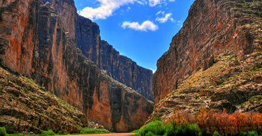
Stand at the mouth of Santa Elena Canyon and you can look at two countries at once. The cliff on your left is in Mexico, the cliff on your right is in Texas, and between them the Rio Grande slips through a limestone chasm 1,500 feet deep. Moments like that are what Big Bend does best.
This is a park of big distances and bigger silence, where desert, river and mountains share one enormous corner of West Texas. It takes some effort to get here, but that remoteness is the reward: uncrowded trails, wide open views and, after dark, the darkest skies of any national park in the lower 48. If you love a road trip with a real sense of adventure, Big Bend belongs on your list and on your map.
Where is Big Bend National Park?
Big Bend sits in far Southwest Texas, tucked into the great bend of the Rio Grande that gives the park its name. The river forms 118 miles of shared border with the Mexican states of Chihuahua and Coahuila.
You can reach the park from Alpine on TX 118 or from Presidio on FM 170, both leading to Study Butte and then 26 miles east to park headquarters at Panther Junction. From Marathon, it is about 70 miles south to headquarters. The nearest major airports are in Midland and Odessa, about 235 miles away, and El Paso, about 330 miles away. There is no public transportation to or within the park.
At 801,163 acres, Big Bend is the 15th largest unit in the national park system. Congress authorized the park in 1935, Texas presented the land to President Franklin D. Roosevelt in 1944, and Big Bend was established as a national park on June 12, 1944. That is why it is often called "Texas' Gift to the Nation."
Three parks in one: desert, river and mountains
Big Bend protects the most representative example of the Chihuahuan Desert ecosystem in the United States. Elevations run from about 1,850 feet at Rio Grande Village to 7,832 feet on Emory Peak, and that range creates an astonishing mix of habitats. Down low you will find cactus country and open desert. Up in the Chisos Mountains, a true sky island, oak, juniper and pine forests feel like another world.
All of that variety supports a remarkable list of life: about 1,295 species of plants, 75 species of mammals, 56 species of reptiles and more than 450 species of birds. No wonder the park is a favorite with birders.
The rocks tell a long story too. The park's Cretaceous and Tertiary fossils make it a rich place to study ancient life, and the award winning Fossil Discovery Exhibit, eight miles north of Panther Junction, is a great stop for curious kids and grownups alike.

Twelve thousand years of history and the darkest skies around
People have lived in and passed through the Big Bend for nearly 12,000 years. The park lists Paleo Indian and Archaic peoples and a variety of southwestern tribes, including the Chisos, Jumano, Mescalero Apache and Comanche, among its earliest residents. You can still drive portions of the Comanche Trail. Around 1900, Mexican settlers began farming both banks of the river, and the Castolon Historic District preserves an old cavalry camp and the La Harmonia store, where locals shopped for decades.
When the sun goes down, Big Bend puts on its best show. The National Park Service has determined that it has the darkest night skies of any national park in the lower 48 states, and it became an International Dark Sky Park in 2012. Rangers and volunteers offer free night sky programs, from star parties to moonlight walks, so check the weekly program schedule.
Best things to do at Big Bend National Park
Drive the Ross Maxwell Scenic Drive
This 30 mile paved road showcases the park's geology, with stops at Sotol Vista, the Mule Ears Viewpoint, Tuff Canyon, historic ranches and Castolon before ending at Santa Elena Canyon. The short Santa Elena Canyon Trail, about 1.7 miles round trip, follows the river into the canyon. Note that the paved road between Cottonwood Campground and Santa Elena Canyon is currently closed due to weather damage, so check road status before you go.
Hike the Lost Mine Trail
This 4.8 mile round trip is a wonderful introduction to the Chisos Mountains. Even if you only hike the first mile to the saddle, you will get stunning views of Casa Grande and Juniper Canyon. Parking at the trailhead, at mile 5.1 on the Basin Road, is limited, so go early.
Walk to the Window
From the Chisos Basin Trailhead, the Window Trail descends 5.6 miles round trip through Oak Creek Canyon to a pour off that frames the desert below. Use caution at the slick rock edge, and save energy for the uphill return. For an easy option, the paved 0.3 mile Window View Trail is wheelchair accessible and perfect at sunset.

Soak in the historic hot spring
On the north bank of the Rio Grande, a 105°F spring bubbles up inside the foundation of an old bathhouse. A one mile loop passes the remains of a resort, pictographs and a homestead. Part of Hot Springs Road is currently closed, so ask a ranger about access.
Visit Boquillas, Mexico
The Boquillas Crossing Port of Entry lets you walk across the border for a visit to the village of Boquillas. A valid passport is required for everyone, and hours change by season, so check the park website before you plan the trip.
Tips for planning your visit
- Best time to go: Fall and spring are usually warm and pleasant. Winters are generally mild, while May and June are the hottest months. The busiest season runs from October through April, especially holidays and spring break.
- Fees and reservations: Check the official NPS website for current fees and any reservation requirements before you go.
- Book your bed early: All park campsites require reservations, and from November through April the campgrounds and the Chisos Mountains Lodge, the only lodging in the park, are full every night. There are no overflow sites, and roadside camping will get you cited.
- Fuel up: Gas is available at Panther Junction and Rio Grande Village. Distances are long, so keep your tank full and carry extra water and snacks.
- Know the rules: Wood and ground fires are not allowed anywhere in the park, and pets are not allowed on trails.
- Road trip pairing: Make it a West Texas adventure by continuing north to Guadalupe Mountains National Park and Carlsbad Caverns National Park.
🐝 A note from PennyBee
Everything is bigger in Texas, including the distance between gas stations, so plan accordingly. The good news is that your pin for Big Bend goes in the same size hole as every other park. Bring a star chart, a full tank and a friend who loves long playlists.
Add Big Bend to your national parks map
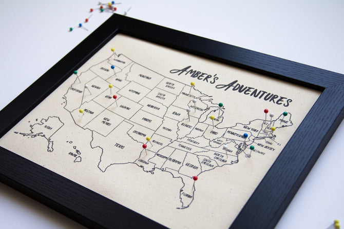
A trip this far off the beaten path deserves to be remembered. Our US National Parks Push Pin Map shows all 64 national parks and comes with a handmade wooden tree pin for each one, so you can mark Big Bend and see just how far your adventures have taken you.

Keep the momentum going with our guide on how to track the national parks you visit, and browse our national and state park maps. Curious how another desert compares? Our Saguaro National Park guide takes you into the Sonoran Desert of Southern Arizona.
Featured image: Photo: R Hensley, CC BY 2.0, via Wikimedia Commons.
